
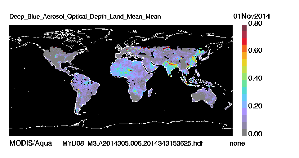
MODIS collection 6 deep blue
The MODIS Deep Blue Aerosol Product monitors the ambient aerosol optical thickness over land surfaces, including bright surfaces such as deserts, by including 412 nm and 470 nm observations. Daily Level 2 data are produced at the spatial resolution of a 10×10 1-km (at nadir)-pixel array. There are two MODIS Aerosol data product file sets: MOD04_L2, containing data collected from the Terra platform; and MYD04_L2, containing data collected from the Aqua platform.
| Satellite | EOS Terra / EOS Aqua |
| Instrument(s) | MODIS |
| Contact details | Christina.Hsu[at]nasa.gov |
| Parameter(s) | AOD, Angstrom exponent, Single Scattering Albedo |
| Aerosol algorithm | MOD04_L2 |
| Cloud screening |
Spatial variance and spectral tests |
| Aerosol model | A suite of aerosol models for dust, smoke, and continental aerosols |
| Retrieval assumptions | Bimodal aerosol model; surface database/spectral relationship |
| Retrieval limitations | Retrieval over land only |
| Spatial, temporal coverage | 2000-present (Terra), 2004-present (Aqua) / NRT, global |
| Spatial, temporal resolution | 10 km / 2330km swath / 16 days repeat cycle |
| Operations status | operational / reprocessing |
| Validation status | Published validation |
| Quality control | Pixel-wise quality flag, and pre-filtered datasets available within files |
| last algorithm version | Collection 6 (reprocessing throughout 2014) |
| last validation | 2013-present |
| Algorithm description (1 and 2) | Product format description |
| Version explanation | Validation summary (1 and 2) |
| Publications |
| Product data access |
| Image / quicklook data access |