
CALIPSO Aerosol
|
|
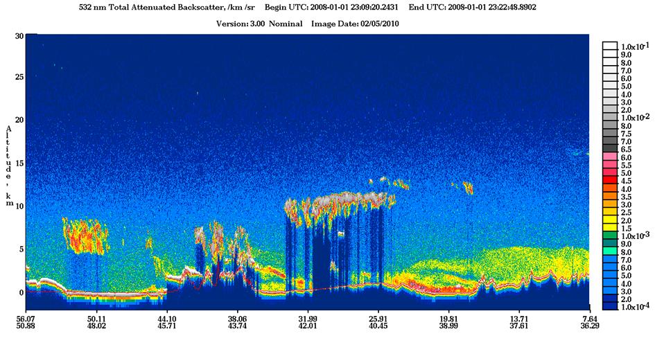
A key piece of information that is not provided by currently operating observational satellites is the altitude of aerosol layers in the atmosphere. Aerosols confined to the lowest part of the atmosphere are likely to be removed quickly by rain. On the other hand, those that are transported to higher altitudes are much more likely to travel long distances and affect air quality in distant countries. CALIPSO provides this vital missing piece of information by LIDAR measurements from space.
|
Example result
|
 |
| Satellite: | CALIPSO |
| Instrument(s): | CALIOP |
| Instrument/algorithm PI: | Dave Winker, NASA |
| Contact details: | David.M.Winker[at]nasa.gov |
| Parameter(s): | AOD, layer height and thickness, extinction profile, aerosol type |
| Aerosol algorithm: | CALIPSO Level 2 Aerosol |
| Cloud screening: | CALIPSO Level 2 Clouds |
| Aerosol model: | CALIOP lidar ratio models |
| Retrieval assumptions: | lidar ratio associated with each aerosol type |
| Retrieval limitations: | retrieve aerosol only within detected layers |
| Spatial, temporal coverage: | 2006-present/ archival, day + night, global |
| Spatial, temporal resolution: | 5km / 1-pixel swath / 16-day repeat cycle |
| Operations status: | operational |
| Validation status: | preliminary |
| Quality control: | via quality flags, uncertainties |
| last algorithm version: | V2.02 (10/2008), V3.01 (03/2010) |
| last validation: | N/A |