SOLEMI data base
|
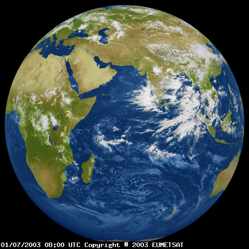
Hourly global and direct normal irradiance for Europe, Africa and Asia Solar Energy Mining (SOLEMI) is a service providing irradiance data. It is mainly based on Meteosat-data with a nominal spatial resolution of 2.5 km and half-hourly temporal resolution. From 2004 the service uses also Meteosat Second Generation imagery with a nominal spatial resolution of 3 km and 15 minutes time resolution.
Solar radiation maps and hourly time series are available on request for:
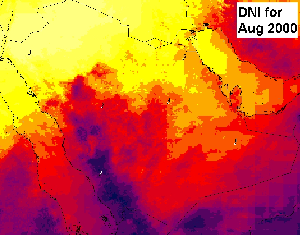
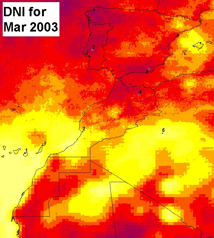
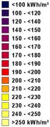
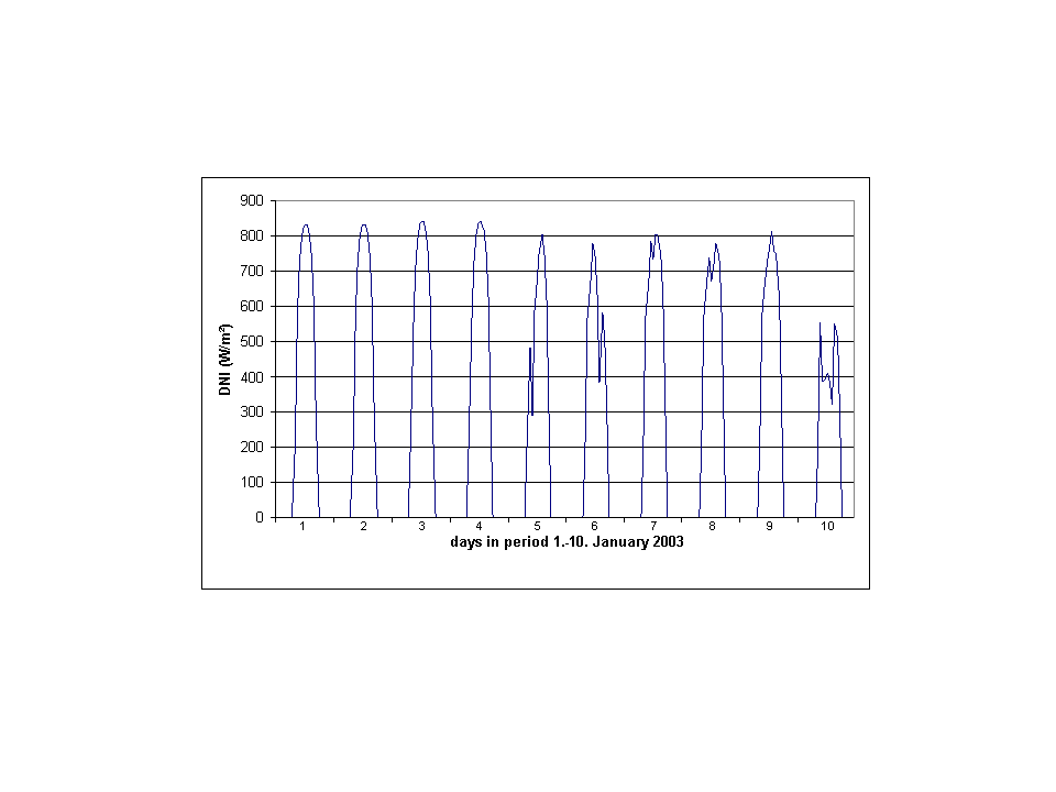
The transfer of the extraterrestrial solar irradiance to the Earth's surface is influenced by various constituents of the atmosphere. Ozone, aerosol and water vapour are modelled with long time climatological and reanalysis data sets. Clouds which have the largest influence and highest variability are determined from the half hourly Meteosat images. Both visible and infrared channels are used to improve the detection at sunrise and sunset and of high cirrus clouds. The Heliosat method was originally proposed by Cano et al. (1986) and later modified by Beyer et al. (1996) and Hammer (2000). The basic idea of the Heliosat method is a two-step approach. In the first step, a relative normalised cloud reflectivity - the cloud index - is derived from METEOSAT images. The derived cloud index is correlated to the clear-sky index k, which relates the actual ground irradiance G to the irradiance of the cloud-free case Gclear sky. Consequently, in addition to the cloud index derived from the satellite signal, a clear-sky model, providing Gclear sky, is necessary for the estimation of the actual ground irradiance. This clear sky model includes knowledge on the sun geometry and atmospheric turbidity to describe aerosol and water extinction. The n-k relation is powerful, validated, and leads to small root mean square deviation (RMSD) between measured and calculated solar irradiance for almost homogenous cloud situations (RRMSD of 13-15% for hourly global irradiance values; Hammer, 2000). The ENVISOLAR science review (A. Zelenka, 2004) states, that the RMSE observed is mainly due to misfit between ground measurement (point) and satellite measurement (pixel average). For global irradiances it is known from variogram analysis, that the accuracy of satellite data is better if the distance between a ground station and the area of interest is larger than 20 to 50 km. For direct irradiance a similar analysis can not be done due to the low density of available ground measurement stations. There has been a variety of validation studies for the Heliosat algorithm. A synopsis of validation results on different time scales for averaging values is given in table 1.
Users and applications using the SOLEMI database: SOLEMI is aimed at decision makers of solar energy projects and atmospheric researchers, which need solar irradiance data for designing solar energy systems. Site audit Solar irradiance atlas Pre-Assessment Study Solar resource studies Solar resource studies additionally look at the technical and economical potential of different solar electricity generation technologies. This will be based on additional geographical and country specific data. Data access: A free example data set covering Europe based on the year 2005 is made available at http://project.mesor.net/web/guest/solemi-free. Further data and time series are processed on request (see contact section). Available products are: - Digital maps of annual or monthly sums or averages - Colored jpeg images - Data of solar irradiance in hourly, daily and monthly resolution
The SOLEMI database is a joint effort of three units at DLR:
Contact: wdc@dlr.de Beyer, H., Costanzo, C., Heinemann, D. (1996). Modifications of the HELIOSAT procedure for irradiance estimates from satellite images. Solar Energy, 56, 207- 21 Cano, D., Monget, J., Albuisson, M., Guillard, H., Regas, N., & Wald, L.(1986). A method for the determination of the global solar radiation from meteorological satellite data. Solar Energy, 37, 31-39 Hammer, A., 2000, Anwendungsspezifische Solarstrahlungsinformation aus METEOSAT-Daten, Dissertation, Universität Oldenburg, http://oops.ibit.uni-oldenburg.de/volltexte/incoming/2001/347/ Meyer, Richard und Lohmann, Sina und Schillings, Christoph und Hoyer, Carsten, 2006, Climate Statistics for Planning and Siting of Solar Energy Systems: Long-Term Variability of Solar Radiation Derived from Satellite Data. In: Nova Science Publishers Earthlink, pages 55-68. ISBN 1-59454-919-2 Zelenka, A., 2004, ENVISOLAR Project - Environmental Information for Solar Energy Industries, project report no. 6 Science Review'
|
||||||||||||||||||||||||||||||||||||||